
Offline GPS tracking with phone
October 05, 2016 —
BarryK
I will be taking off soon on another hike. On the last walk, I lost the
track a couple of times, so I need GPS tracking for hiking further
afield.
These days, a dedicated GPS device is not needed, a smartphone will do. Or so I am lead to believe -- I am a complete newby in this area.
I read reports in some bush walking forums, and came up with a short list of GPS apps for Android.
Then I narrowed it down to one, AlpineQuest. Firstly, I tried the free Lite version, really loved it, so paid US$9.99 for the Full version.
Note, I first uninstalled the Lite version, then installed the Full version.
I got it from the Google Play Store:
https://play.google.com/store/apps/details?id=psyberia.alpinequest.full
My main interest is the Bibbulmun Track, and lots of maps are available. Apparently, these are automatically cached locally, for off-line use. I will soon be testing that, as the walk that I intend taking very soon will be mostly where there is no mobile signal.
Here is the website for AlpineQuest:
http://www.alpinequest.net/en
I have just done a quick test print. Showing the Bibbulmun Track running East from Mundaring Weir:
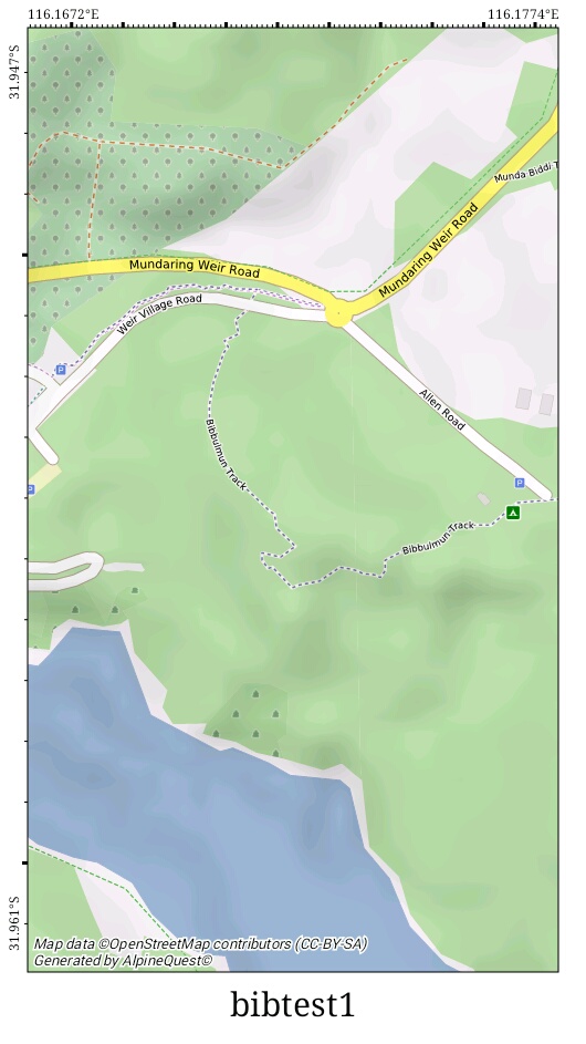
The green square on the right is the Perth Hills Discovery Centre.
There are many different maps that can be chosen, and they can be overlaid, with variable opacity. In the photo, I have chosen highlighted hills overlay. Another choice would be contours.
Of course, once I am there, my location will be shown as well.
Tags: light